Get accurate altitude readings anywhere, even offline. Designed for outdoor enthusiasts and professionals who need reliable elevation data in remote locations.
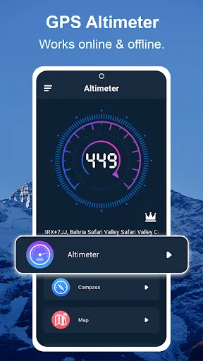
Navigate confidently in remote areas with full offline functionality. Our GPS altimeter provides accurate readings even where cell service doesn't reach, keeping you informed no matter how far you venture.
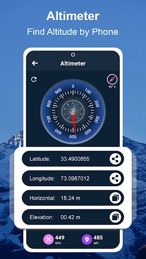
Get professional-grade accuracy using combined GPS and barometric data. Monitor your elevation, ascent rate, and descent in real-time to make informed decisions and stay safe on every journey.
Access everything in one app – altimeter, digital compass, and detailed maps. No need to juggle multiple tools when you're on the trail or working in the field.
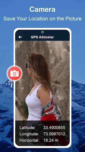
Mark and store important spots for future reference. Perfect for remembering great camping sites, mapping survey points, or tracking pipeline locations you need to revisit.
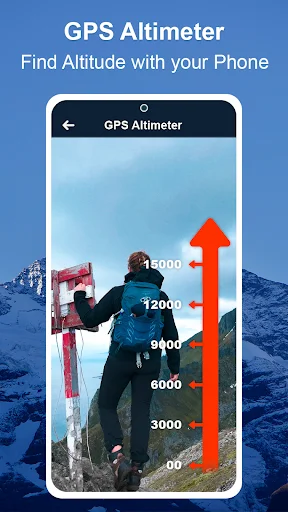
GPS Altimeter - Altitude App is an advanced tool designed for outdoor enthusiasts, hikers, and professionals who require accurate altimeter and location information. 🧭📈
This GPS altitude app is an accurate altimeter that uses GPS and barometric data to provide reliable altitude readings.✔️
This altimeter GPS offline utilizes advanced technology to determine your exact altitude, even in challenging terrain or adverse weather conditions. Whether you're a pilot, a mountain climber, or an outdoor enthusiast, an Accurate Altimeter - GPS Altitude App is an essential tool to help you navigate and stay safe.
One of the vital features of a GPS Altimeter app is its high level of accuracy. With a sensitive GPS receiver, the smart altimeter can provide precise altitude readings for accurate navigation and safe travel. The device may also utilize additional sensors, such as a barometer or an accelerometer, to ensure even greater accuracy and reliability.
🧭Features of the GPS Altimeter - Altitude App:🧭
Altimeter GPS offline will provide real-time information about your altitude. This can include your current elevation, rate of ascent or descent, and total ascent or descent distance. This information can be displayed on a clear and easy-to-read screen, allowing you to monitor your altitude and adjust your course as necessary.
The GPS altitude app's ability to function as an altimeter GPS offline is particularly beneficial for areas with limited or no internet connectivity, making it a necessary tool for outdoor adventures.
The GPS altimeter feature taps into your device's GPS capabilities to offer precise altitude readings. This technology is beneficial for mapping out hiking trails, surveying land, or any activity where understanding your exact elevation is crucial.
The GPS altitude app provides altitude data, coordinates, and other geographical information, making it a comprehensive smart altimeter tool for navigation and exploration.
Its combination of accurate altimeter technology, GPS altitude app features, and smart altimeter design makes it a top choice for outdoor enthusiasts, travelers, and professionals alike. Whether online or offline, this GPS altimeter app ensures that accurate altitude information is always within reach.